Penarth and Storm Jorge: Weather Updates as Train Lines Close
By The Editor 28th Feb 2020


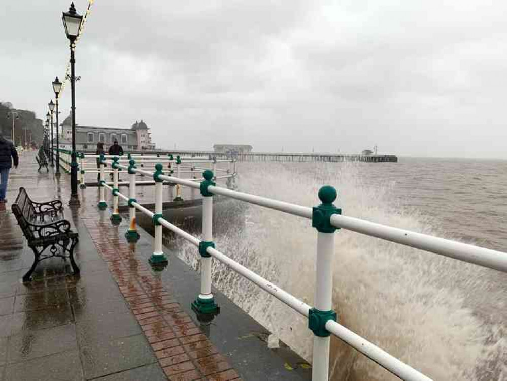
Storm Jorge has started to take hold and so we will be updating local residents on any changes to the weather and its impact on Penarth town. Keep this page open for regular updates.
UPDATE (16:59): The Vale Council have announced that: ''A limited number of sandbags are available for Vale residents to collect from Court Road Depot in Barry.
''There is a maximum of 10 per household. Please bring a form of identification.''
South Wales Police have also issued a statement. They said: We are receiving a high volume of reports from across Bridgend and the Vale of Glamorgan relating to the poor weather conditions.''
UPDATE (15:03):
Penarth RNLI tweet: ''With more flood warnings on the River Taff and forecasts of poor weather we're asking people to stay safe this weekend.'' UPDATE (14:07): Flooding Immenent from the River Cadoxton at Dinas Powys. Natural Resources Wales has upgraded the weather warning to a Flood Warning from a flood alert with flooding expected and immediate action required. What you should consider doing now:• Act on your flood plan if you have one.
• Move your family and pets to a safe place.• Move your car or other vehicles to higher ground, if it is safe to do so.
• Use flood protection equipment, such as flood barriers, air brick covers and pumps to protect your property. Any equipment should be professionally supplied and installed to help reduce the impact of floodwater.• Move important items upstairs or to a safe place in your property, starting with cherished items of personal value that you will not be able to replace (such as family photographs). Next move valuables (such as computers), movable furniture and furnishings.
• You may need to leave your property, so pack a bag with enough items for a few nights away. Include essential items including a torch with spare batteries, mobile phone and charger, warm clothes, home insurance information, water, food, first aid kit and any prescription medicines or baby care items you may need.• Turn off gas, electricity and water mains supplies before floodwater starts to enter your property. Never touch an electrical switch if you are standing in water.
• If it is safe to do so, make sure neighbours are aware of the situation and offer help to anyone who may need it.• Listen to the advice of the emergency services and be ready to evacuate your property if told to do so. Most evacuation centres will let you bring your pets.
• Avoid walking, cycling or driving through flood water. 30 cm of fast-flowing water can move a car and 15 cm can knock an adult off their feet.• Floodwater is dangerous and may be polluted. Wash your hands thoroughly if you've been in contact with it.
UPDATE (13:48):
The Vale of Glamorgan Line has been shut following heavy rain in the South Wales area.
Transport For Wales said: ''Due to significant rainfall across South Wales, there is disruption to a number of our routes, with limited road transport available at present.''
Train Line Closures:
• Line closed between Bridgend and Cardiff• Line closed on the Vale of Glamorgan route
• Line closed on the Treherbert branch• Line closed on the Ebbw Vale branch north of Cross Keys
• Disruption to services through Trefforest and on the Rhymney Valley line ''We are endeavouring to source as much road transport as possible and Network Rail staff are working hard on site to improve conditions.'' - - - - - - - Storm Jorge will bring heavy rain and strong winds on Saturday for Penarth. This follows on from the yellow rain warnings announced for Friday in the local area. The Met Office's local weather forecast displays winds of up to 50 MPH winds for Penarth at approximately 3 pm. The weather warning for wind is in place in the town from midnight on Saturday until 12 noon on Sunday. Traffic Wales have asked residents to: ''Please take care, slow down and drive to the conditions.'' A spell of strong winds is expected to move northeast across a large swathe of the UK through Saturday afternoon and Sunday morning. What to expect:- Some delays to road, rail, air and ferry transport are likely.
- Delays for high-sided vehicles on exposed routes and bridges likely.
- It's likely that some coastal routes, sea fronts and coastal communities affected by spray and/or large waves.
Named by the Spanish meteorological service Agencia Estatal de Meteorología (AEMET) on Thursday, Storm Jorge will track across the north-west of the UK over the weekend bringing another spell of strong winds and heavy rain.
Chief Meteorologist at the Met Office, Paul Gundersen, said: "This weekend we'll see another named Storm bring strong winds to parts of the UK with several wind and rain warnings in place.
"On Friday a band of rain associated with Storm Jorge will move across the UK - we have issued rain warnings for parts of Wales and northern England, where rain will be heaviest and we could see 60-80mm possible over the highest ground.
''South-westerly winds will strengthen through Saturday morning and it'll turn widely windy except for northern Scotland, with wind warnings in place for Northern Ireland, Wales, southern Scotland and much of England.
''Where warnings are in place gusts of 50-60mph are likely quite widely with 65-70mph possible in coastal areas, however, the strongest and most damaging winds are expected across the Republic of Ireland."
Penarth Nub News will keep residents informed of any updates to travel.
CHECK OUT OUR Jobs Section HERE!
penarth vacancies updated hourly!
Click here to see more: penarth jobs
Share:


