Yellow Thunderstorm Weather Warnings Issued for Penarth
By The Editor 16th Jun 2020


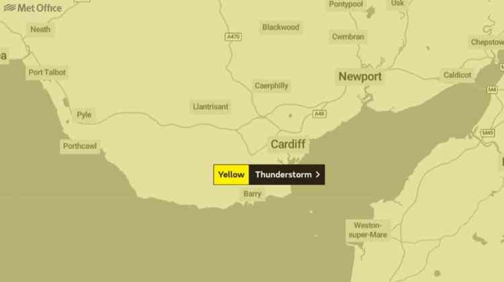
A yellow thunderstorm warning has been issued for Penarth and surrounding areas over the next couple of days as well as a general turn in the weather.
This is the first weather warning since the string of floods in late February for Penarth.
Slow-moving heavy showers and thunderstorms will break out across many parts of the UK on Tuesday afternoon.
Some places will miss them, but where they do occur they will bring torrential downpours with 25 to 35 mm rain falling in an hour and perhaps 40 to 50 mm in 2 to 3 hours in one or two places. Lightning and hail will be additional hazards.
The Met Office states:
Tonight -
Heavy showers will linger through the evening and overnight, with a risk that these could turn thundery with some hail at times. ''Showers should slowly ease through into the early hours, but staying rather cloudy with patches of fog developing. Minimum temperature of 11 °C. Wednesday -Spells of sunshine in the morning once any patchy fog clears. The afternoon should see heavy showers and the odd thunderstorm breaking out, gradually fading away into the evening. Maximum temperature of 22 °C.
Outlook for Thursday to Saturday -
Remaining unsettled on Thursday with locally heavy, perhaps thundery rain. Drier on Friday with sunny spells and showers, before further outbreaks of rain, begin to arrive through Saturday. What to expect:• Flooding of homes and businesses could happen quickly, with damage to some buildings from floodwater, lightning strikes, hail or strong winds
• Where flooding or lightning strikes occur, there is a chance of delays and some cancellations to train and bus services• Spray and sudden flooding could lead to difficult driving conditions and some road closures
• Some communities might become cut off if roads flood• Power cuts might occur and other services to some homes and businesses could be lost
CHECK OUT OUR Jobs Section HERE!
penarth vacancies updated hourly!
Click here to see more: penarth jobs
Share:


